El Camino Real de los Tejas: A Ride Through History

Many roads claim to take you on a ride through history. But El Camino Real de los Tejas does that quite literally. Also called the Old San Antonio Road, it covers roughly 2,500 miles of paths from Laredo, TX, to Natchitoches, LA. Its origins stretch back to the late 17th and early 18th centuries, when it served as a royal road (or camino real) in Spanish Texas. The road’s name, like that of the state of Texas, stems from the Caddo Native Americans. The Spanish called them the “Tejas” after a Caddo word meaning “friend” or “ally.”
It’s difficult to define a single route that El Camino Real takes. Even a brief glance at official maps (available on the National Park Service website) reveals a sprawling collection of trails—some of which no longer exist. This jumbled character is a result of historical patterns of migration and colonization.
Due to French encroachment, Spaniards attempted to push into southeastern Texas and western Louisiana in several waves, most of which failed. The Spanish abandoned the first missions built in east Texas in the 1690s after the Caddo strongly suggested they go back or face a quick and unpleasant end. In 1716, larger-scale colonization began, and the Spaniards stretched El Camino Real to Louisiana. There, they founded the fort of Los Adaes as the capital of Spanish Texas, just 12 miles west from the French outpost of Natchitoches.
Life at the Spanish frontier wasn’t easy. El Camino Real’s immense length and dangerous conditions practically cut off the eastern fringe from the colonial heartland. In fact, Los Adaes survived mostly through illegal trade with its French enemies. By 1770, the Spanish authorities had enough and abandoned Los Adaes. Its residents trudged back along El Camino Real to the new capital of San Antonio. The road remained a significant traffic artery all through the Republic of Texas period. Its significance began to diminish only after the U.S. annexed Texas in 1845.
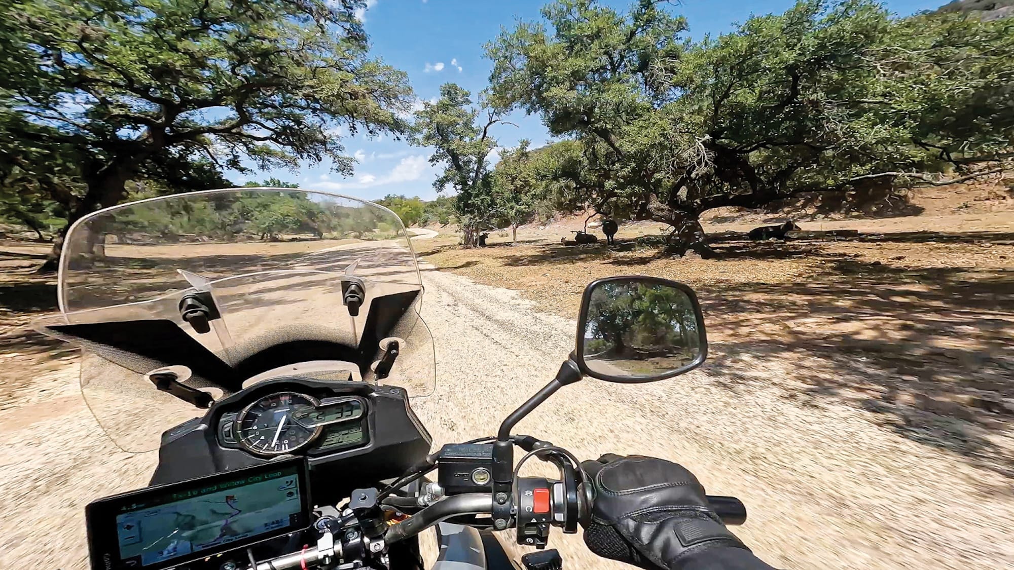
So, how do you ride this spiderweb of ancient routes? The most straightforward way is to motor from Laredo to San Marcos. Once there, pick up Texas SR 21, follow it to the state border, and continue on Louisiana SR 6 to Natchitoches. This 600-or-so-mile path more or less follows one of the main alignments of El Camino Real.
But perhaps the best way to enjoy this ride is to plan your own route. Examine the available maps, make a list of the things you want to see, and connect them along the roads closest to El Camino Real’s ancient paths. This way you get a taste of what braving the unknown on the old roads was like. You’ll also get a better appreciation for El Camino Real’s historical role in connecting people, places, and cultures over time.
Points of Interest
Republic of the Rio Grande Museum
The Republic of Texas was the most famous and successful breakaway Mexican region in the 19th century, but it wasn’t the only one. A regime called the Republic of the Rio Grande existed just south of the current Texas border for a few months in 1840.
The Republic of the Rio Grande Museum in Laredo, TX, showcases the history of this short-lived political entity through a collection of objects and furniture. Even the 1830 house the museum occupies is an artifact in itself, having reportedly served as the capitol building of the republic.
Find it at 1005 Zaragoza St, Laredo, TX.
Old Missions
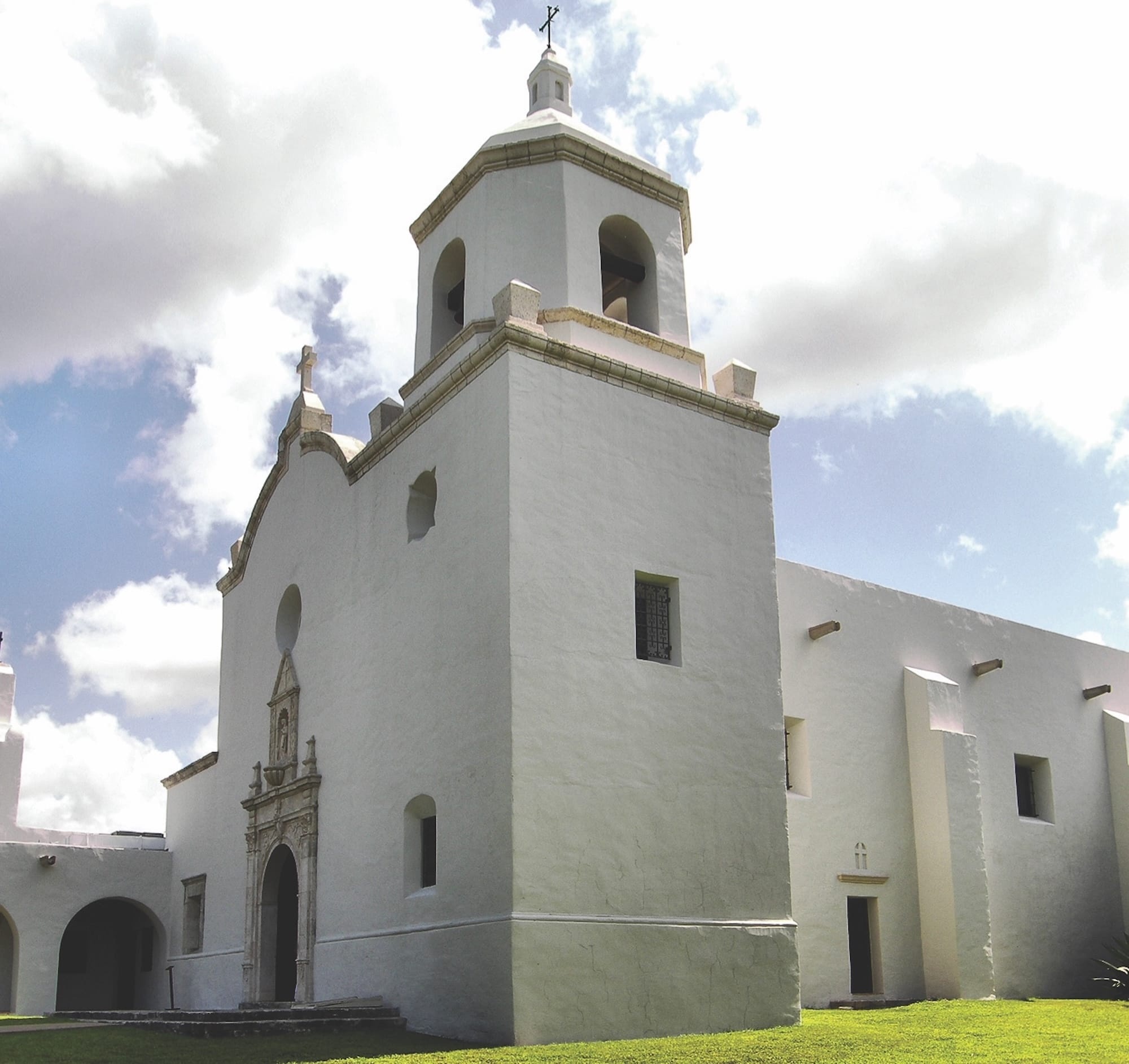
The main vehicle of Spanish colonialism in eastern Texas (and all of America) was the establishment of Catholic missions. They served as a base for settlers and led the attempts to Christianize the native populations. Some missions in the area stand to this day, while others lay in ruins.
Frankly, there are too many significant missions along El Camino Real to list individually. One highlight is Mission Nuestra Señora del Espíritu Santo de Zúñiga. This mission moved three times in the area around modern Goliad and Victoria, TX, and each site has a ruin you can visit.
Caddo Mounds State Historic Site
The Caddo people inhabited the areas of eastern Texas before the Spaniards arrived. Although generally friendly toward the encroaching Europeans, they did at times unceremoniously tell them to take a hike when Spanish plans didn’t mesh with native life.
At the Caddo Mounds State Historic Site near Alto, TX, you’ll find three large earthen mounds built by the Caddo that once supported a thriving village. Both guided and self-guided tours take you around the area where you’ll find reconstructed grass houses and other artifacts.
Find it at 1649 SR 21, Alto, TX.
Los Adaes State Historic Site
The Los Adaes State Historic Site is located where the aforementioned easternmost Spanish settlement in the area of the modern U.S. once stood. Despite its extremely remote location at the end of the dangerous El Camino Real, Los Adaes served as the capital of Spanish Texas for nearly 50 years.
This historic site, still 12 miles west of Natchitoches, hosts various live demonstrations of the difficult life at Los Adaes. Walking trails take you around the most significant locations at the site.
Find it at 6354 SR 485, Robeline, LA.
Facts & Info
Best Time to Travel
As the Spanish colonizers traversing El Camino Real quickly learned, spring and fall are the best times of year to travel through Texas. During both seasons, temperatures usually stay between 60 and 80 degrees.
Most motorcyclists consider September to November to be the ideal riding season in these parts, as the humidity is lower and you can enjoy beautiful fall leaves in forested sections. That said, spring brings with it blooming wildflowers (like those on the Bluebonnet Trail).
A summer ride along El Camino Real is a possibility if you can stomach daytime temperatures soaring past the three-digit point. Keep your riding to the morning and late afternoon and use the best heat management practices.
Resources
- El Camino Real de los Tejas
- El Camino Real de los Tejas on NPS
- Republic of the Rio Grande Museum
- Caddo Mounds State Historic Site
- Los Adaes State Historic Site