South Central Missouri's Alphabet Roads
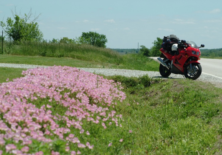
My Honda VFR's odometer spins past 30,000 as I enter the Missouri River town of Boonville. Over the years, I have ridden some of what I thought were the Show-Me State's finest back roads. However, these roads were mostly confined to Missouri's extreme southern border, where it butts up against the Arkansas hill country. Jumping off the main line, I had my doubts that the roads this far north would offer much excitement.
Crossing the mighty Missouri late in the day, I ride into Boonville looking for a side street to take me to the river's edge. I had been thinking of ceremoniousy dipping my front tire in the river to bookend the beginning and end of this tour, but abandoned the idea when discovering the closest I could get was the employee parking lot of the Isle of Capri Casino.
Once outside town, State Route 87, a lightly traveled two lane, becomes part of the national Lewis and Clark Trail, with Clark's Fork being the first town I pass through. Less than five miles later, I see the hamlet of Prairie Home and couldn't help mentally adding "Companion" to the town's name as a tip-of-the-hat to public radio's Garrison Keillor.

State Route 87, although interesting, doesn't pay any real homage to Lewis and Clark around here, and after 23 miles I'm relieved to see the familiar L&C sign leading me closer to their transportation route of choice, the Missouri River. A left turn onto SR 179 and 10 miles of riding bring me to the river's edge. After another 23 miles of rollicking blacktop, a tribute to the state's transportation department, SR 179 terminates in Jefferson City, Missouri's capital.
Motorcycle & Gear
Honda VFR 750
Helmet: Arai Vector
Jacket: Hein Gericke
Boots: 38-year-old Red Wings
Gloves: Firstgear
Luggage: Eclipse tank bag, Eclipse tail bag
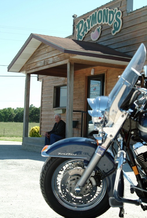
After passing up the continental breakfast at the Motel 6, I leave town with a desire to sample some of Missouri's alphabet roads and start out on County Road C. Rounding an uphill, off-camber corner, a splendid early 20th-century church catches my attention as I enter Russellville. Distracted, I initially miss my left-hand turn onto CR V. And although it's only a short five-mile jaunt, V demands concentration while also prodding the road racer in you to come out and play. Upon reaching CR A, a right turn delivers an arrow-straight ride, reuniting me with our friend SR 87. Running south for nine miles, I'm once again on the alphabet roads with turns on CR Y and W, and heading south to Lake of the Ozarks.
Lakes and Technical Highways
Created by the Bagnell Dam, Lake of the Ozarks and its accompanying city, Lake Ozark, is a beehive of activity. No slow pleasant rides along the lake's southern edge. Instead, while riding these challenging strips of blacktop, you seldom even see the lake. It appears that Lake of the Ozarks' spectacular scenery is best seen from the water.
Leaving CR W, I pick up CRs MM and TT, then SR 5 for a short, but spirited ride into the town of Hurricane Deck. No gale force winds blowing this day, just some late morning traffic as I merge onto SR 7 south and pass through Camdenton. On the map, the 22-mile run between Camdenton and Richland might appear lackluster, but as the road tightens up and the traffic disappears, SR 7 turns into a gem with a series of hills and technical curves before it runs headlong into Interstate 44.
At Laquey, directions become a little dicey as I make my way to SR 17. My objective (the proper term, too, since I'm within howitzer range of Fort Leonard Wood) is to follow SR 17 south. This stretch of macadam gives me a chance to travel through the hardwood beauty of the Mark Twain National Forest without breaking a sweat. Long straights and gentle curves are the order of the day for this 40-mile excursion.
Eight miles past Success, I reach SR 38, and the compass heading finally swings west. In contrast to SR 7's rollicking ride earlier in the day, SR 38 reminds me of southwestern Wisconsin. Open pastures with Big Macs on the hoof, held in check with plenty of barbed wire. Promising to cut down on red meat, I beat a hasty retreat south on SR 95 for 13 miles to Mountain Grove. It seems that Missouri's Department of Transportation ran short of "curve ahead" signs and just cut a straight 15-mile swath south into town here.