Northern Arizona
I awake in Flagstaff to a dusting of snow on the trees and bushes. More of the same is heaped upon the naked rock that crowns Humphrey's Peak, the highest point in Arizona. This sharp summit, stretching 12,633 feet above this old railroad town, tears holes in the fast-moving storm clouds, and I'll come to use it like the North Star to navigate in Northern Arizona.
The bird's eye view from the pinnacle takes in the Mogollon Rim to the southeast, the Hopi and Navajo Nations to the east and north, and the Grand Canyon to the north. I know the ride to these destinations rolls through some of the world's most famous scenery - and to top it off, I'm lucky enough to be trying out the Gold Wing 1800.
Flagstaff
For the time being, though, I've spent two days holed up in Flagstaff, waiting out a late-April snowstorm that has kept the streets covered. I arrived the day before from Phoenix, where it was 85 degrees. The Arizona weather this time of year can be so fickle from one hour and one elevation to the next that snapping the liner in and out of my jacket becomes as common as a gas refill. From the look of things, a chilly wind blowing and dark clouds forming above, I'll have to bide my time at least one more day.
On the other hand, Flagstaff is not such a bad place to be sidelined. The city stretches right up to the feet of the San Francisco Peaks, and Humphrey's Peak is a postcard backdrop for the town of artists, students, and outdoor adventurers. Grateful Dead stickers adorn decayed station wagons and shiny SUVs alike. Dreadlocks are as ubiquitous as fleece jackets here, and I even heard one guy refer to the town as "The Flag, man."

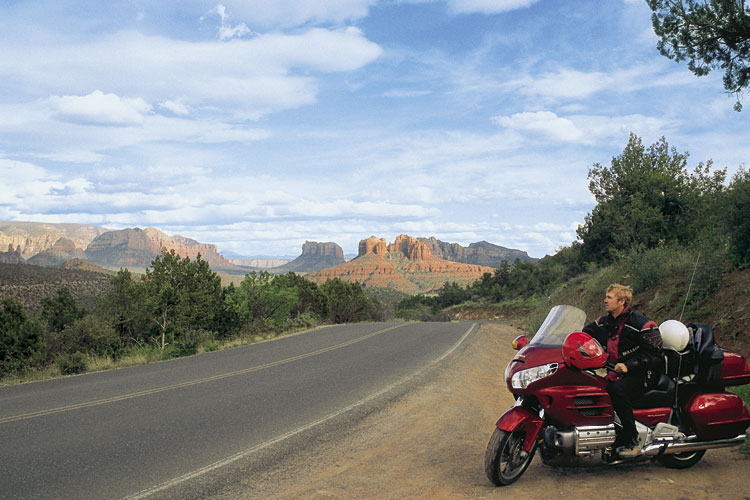
Flagstaff offers plenty to see and do. The city's historic district, with its breweries, art galleries, and Native American jewelry stores is a bustling, vibrant place. The heavy rumbling of trains frequently passing alongside Route 66 and right through downtown provides a distinct aural pulse. There are also the attractions of several museums, including the Museum of Northern Arizona (on the way to the Grand Canyon along US 180), an observatory, and three national monuments within easy driving distance. The famous Red Rocks and Sedona are located just a twisty, half-hour drive south of Flagstaff into the Oak Creek Canyon.
Finally on the Road to the Grand Canyon
The next morning is chilly, but the sun is shining and the snow has melted from the roads. The anticipation almost over, the Grand Canyon soon in sight, I snap the liner into my riding jacket and point the Wing north out of Flagstaff. Past Humphrey's Peak on my right, and letting the rpm climb high, I'm ascending into the Kaibab National Forest. When the road begins to flatten out, I'm on top of the Coconino Plateau, part of the larger Colorado Plateau.
A few sweepers through the northern stretches of the San Francisco Peaks give way to the long and predominantly straight US 180. Pinyon pine forests stretch to the edge of the horizon along most of the plateau, but Humphrey's Peak is always visible in the rearview mirror. The rising sun begins to warm the air, and my excitement about seeing the greatest natural wonder in North America grows stronger.
Most visitors first see the Canyon, invisible on the approach, when they leave their vehicles and carefully step to the edge of the great divide. Eighteen miles away is the opposite edge of the great chasm, like another world altogether, and such is the drama of the sight that it's nearly inconceivable that both worlds could be connected. But on the canyon floor, a mile down, the serpentine blue-green ribbon that has carved this mammoth gorge from the earth's crust joins these worlds again. It's taken the Colorado River several million years of rock gouging to produce this stunning landscape. Looking from the canyon's edge it seems the view is limitless - sometimes it can be around 50 miles - and there is nothing in sight to suggest the canyon ends.