Maggie Valley, North Carolina Shamrock Tour®

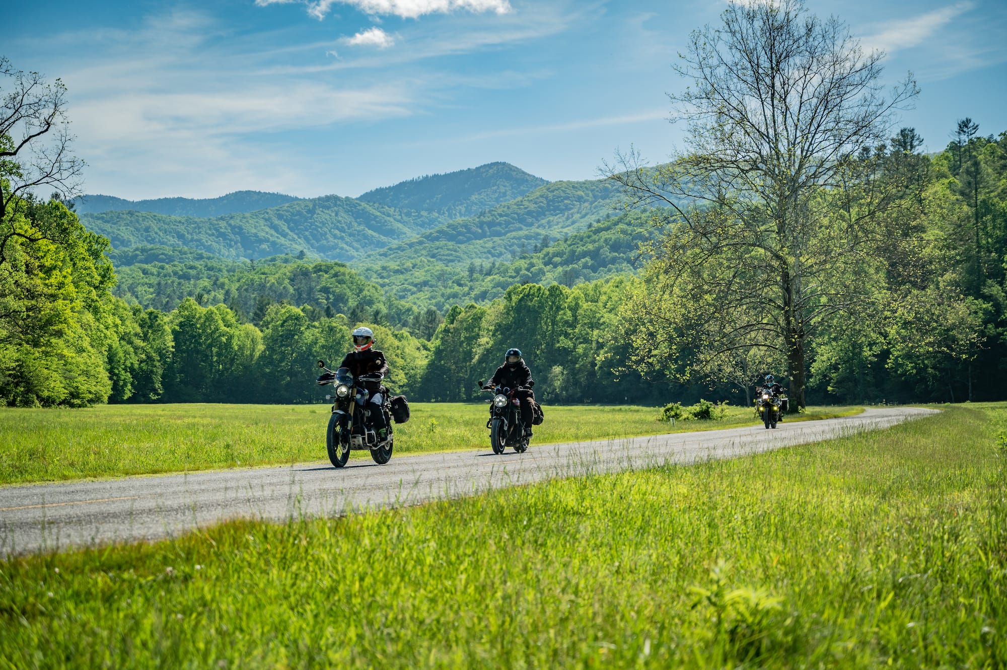
Last year, RoadRUNNER ran a contest to promote our new website platform and web subscription option. The winner and one friend would get to tag along on a RoadRUNNER Shamrock Tour® with myself and our Editor-in-Chief, Florian. We received an incredible response from our readers, many of which were eager to win this unique chance to get a behind-the-scenes look at what it takes to create one of our famous Shamrock Tours.
Christina Stephens was the winner of our grand prize drawing. A long-time RoadRUNNER subscriber, she is based in Nashville, TN, and rides a Kawasaki Z900RS. She is a master jeweler, and runs her own Valkyrie jewelry line, making unique motorcycle-inspired pieces. We couldn’t have lucked out with a better person to join us.
She chose to invite her good friend Jennifer Eskew, who rides a BMW F 700 GS. They’ve been friends and riding partners for six years, but their inside jokes and sense of humor make them seem more like sisters. As you might imagine, Florian was stoked to spend the week riding with three lovely ladies, although I’m not sure he really knew what he was getting himself into.
The Off-Season Route
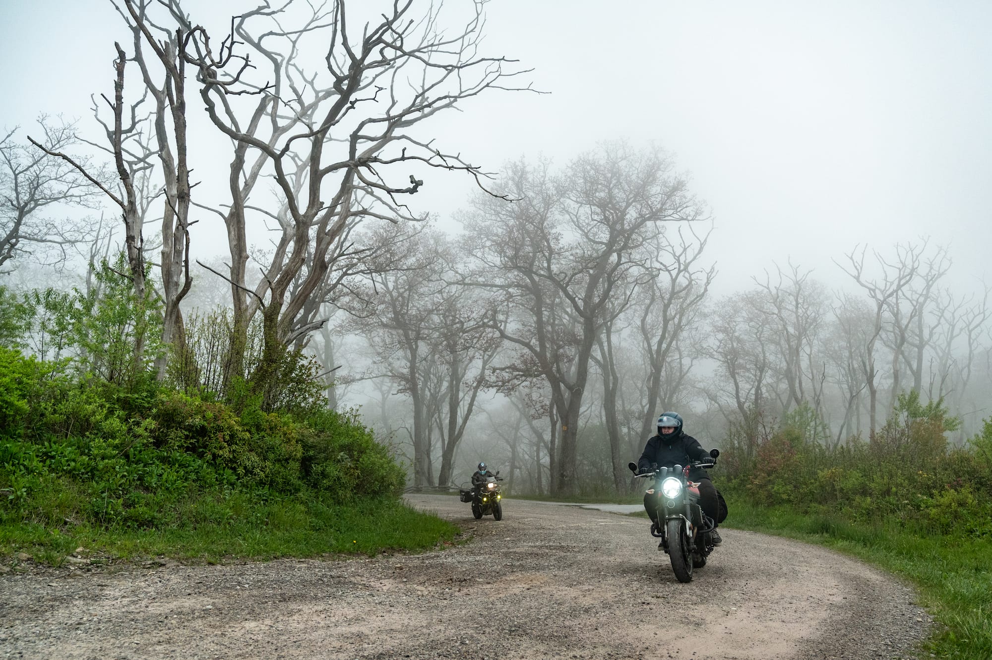
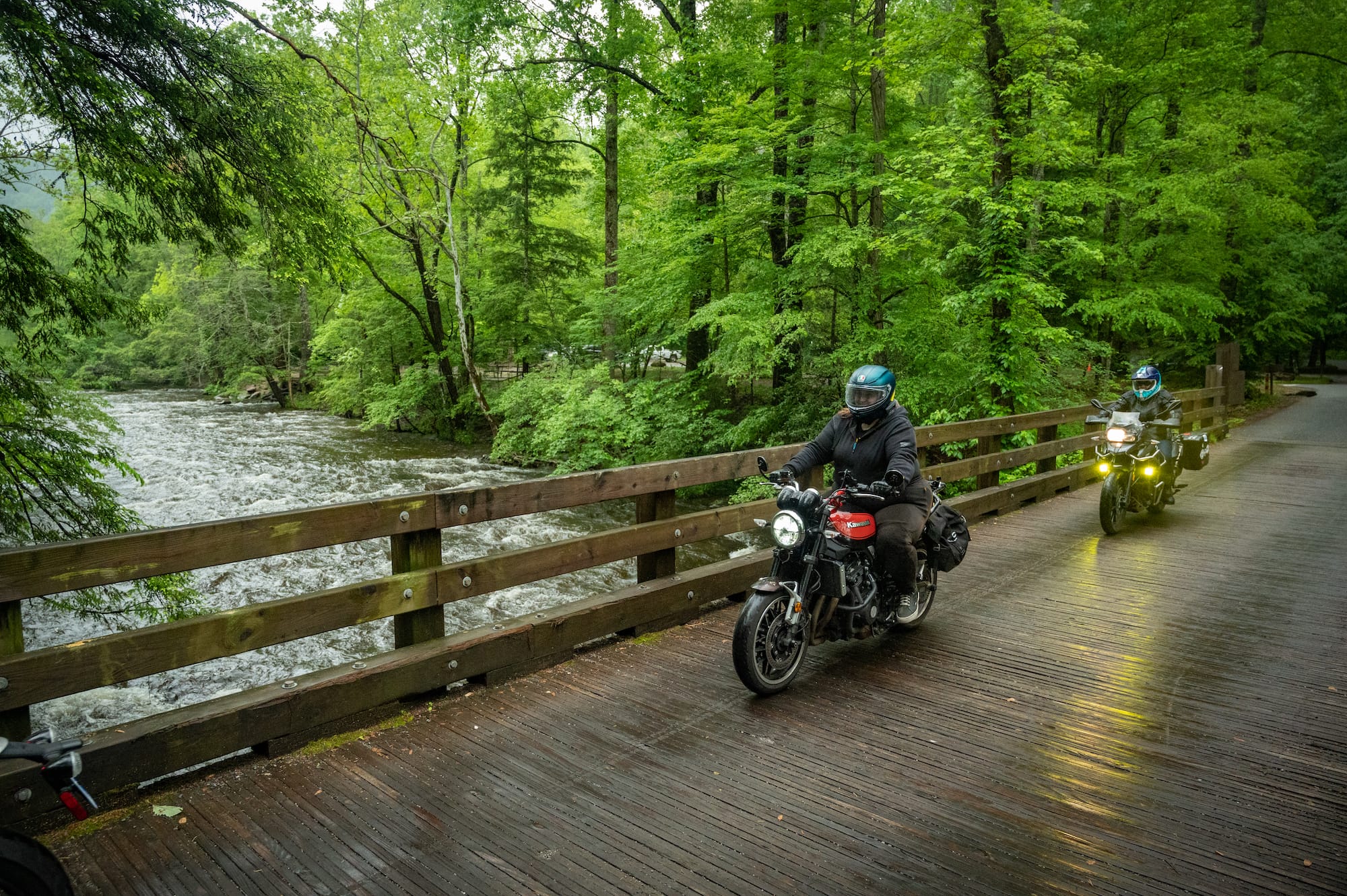
It was chilly and a light mist hung in the air as we set off on our first route. Wearing only a mesh jacket, I quickly remembered that even though it was 80 degrees back home, the mountains are on their own weather schedule. Luckily, I had packed a rain jacket in the saddlebag of the Ducati Scrambler I was riding, which saved me from an uncomfortable 190 miles. With the fog hanging low and roads damp, we followed a route I would only attempt during the week in the off-season.
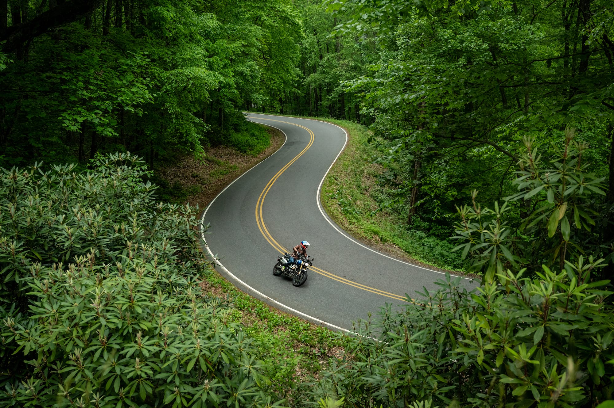
Newfound Gap Rd (Hwy 441) stretches 35 miles from Cherokee, NC, to Gatlinburg, TN. For most of the year, it sees bumper-to-bumper traffic as hordes of vacationers flock to the Great Smoky Mountains National Park to get their “family outdoor experience” for the year. Normally, this is the type of road we try to avoid on two wheels, but the dramatic cliffs and views of the mountains make the attempt worthwhile before Memorial Day.
As we made our way up Newfound Gap, the fog thickened and a light rain spattered our faceshields. The roads were slick and we gently rolled through each corner, wishing we could see more than 50 yards ahead of us. Yet, we were thankful for being able to keep forward momentum up with light traffic. Our only slowdown was to carefully pass a female elk on the side of the road. Even though we missed the views we were hoping for, the ride into Gatlinburg was beautiful. The road glistened with moisture, and the forest was vibrantly green, thanks to all the new vegetation the rain had saturated.
The misty rain stopped as we made our way around the Parkway Bypass and small patches of blue began appearing in the sky. By the time we turned off US 321 and onto Hwy 32, we were starting to dry out. Hwy 32 is one of those hidden gems that not many know about. It runs 14 miles along the northeastern edge of Great Smoky Mountains National Park connecting US 321 and I-40.
We picked up the pace as we danced through the corners together, leaning into each apex in an unrehearsed synchrony. The dry asphalt was tacky under the tires for the first time all day and we didn’t pass a single oncoming vehicle. These are the roads I love finding by accident.
As we neared our next turn, the pavement ended and a nicely groomed gravel road took its place. We couldn’t be upset, as the gravel portion only lasted about a mile before pavement began again. Plus, it was worth it to ride that twisty blacktop through the gap.
Toward the end of the route, the sun came out to warm us up. Our gear finally dried completely, so we decided to take a detour to Cataloochee Valley, known for elk sightings. To get to Cataloochee, you must travel three miles along a gravel entrance road. The road is passable on any motorcycle as long as you take your time. We didn’t see any elk, but enjoyed the few extra sunny miles anyways.
Chasing Waterfalls
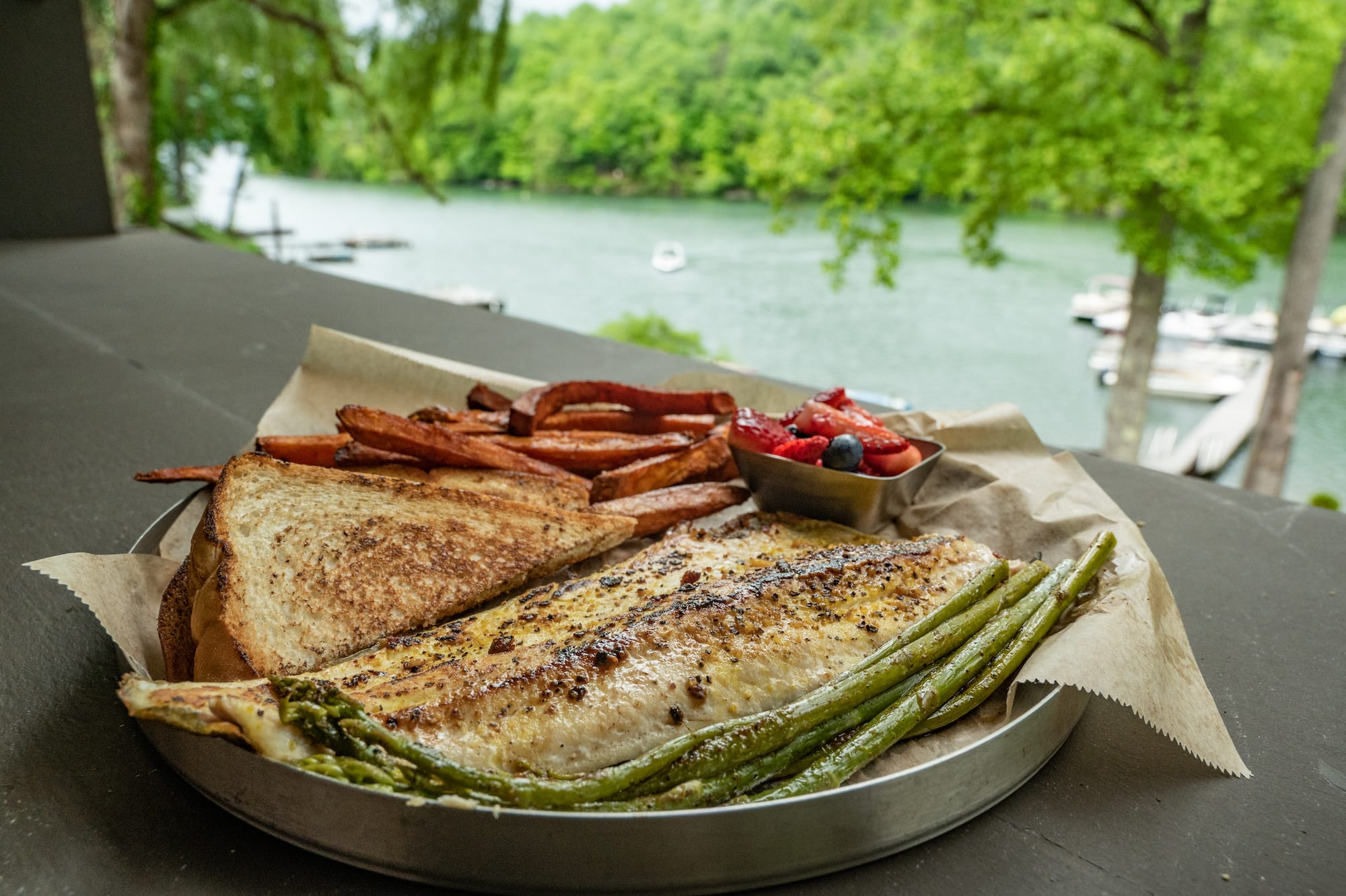
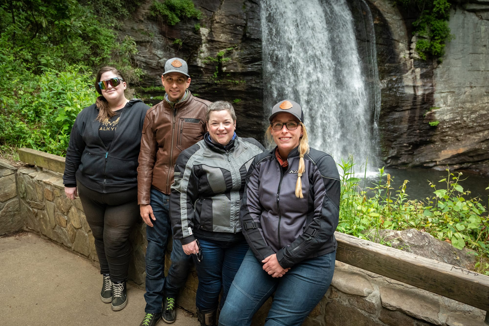
The weather was in our favor the next morning and, after a filling breakfast at Country Vittles, we took off on what would be the longest riding day of the tour. Not only would the day be focused on twisty pavement, but we would also be on the lookout for some of the most scenic waterfalls in the region.
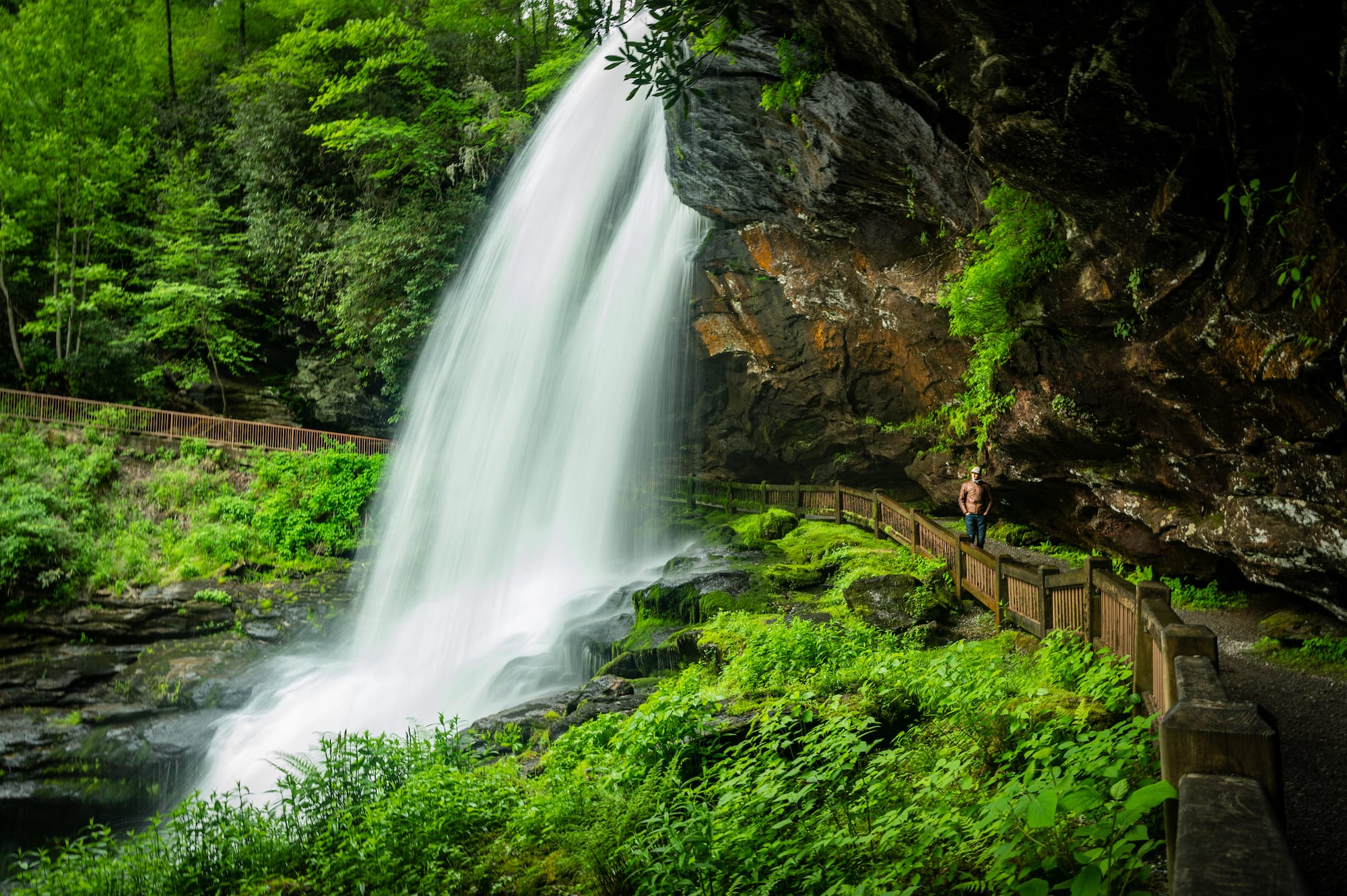
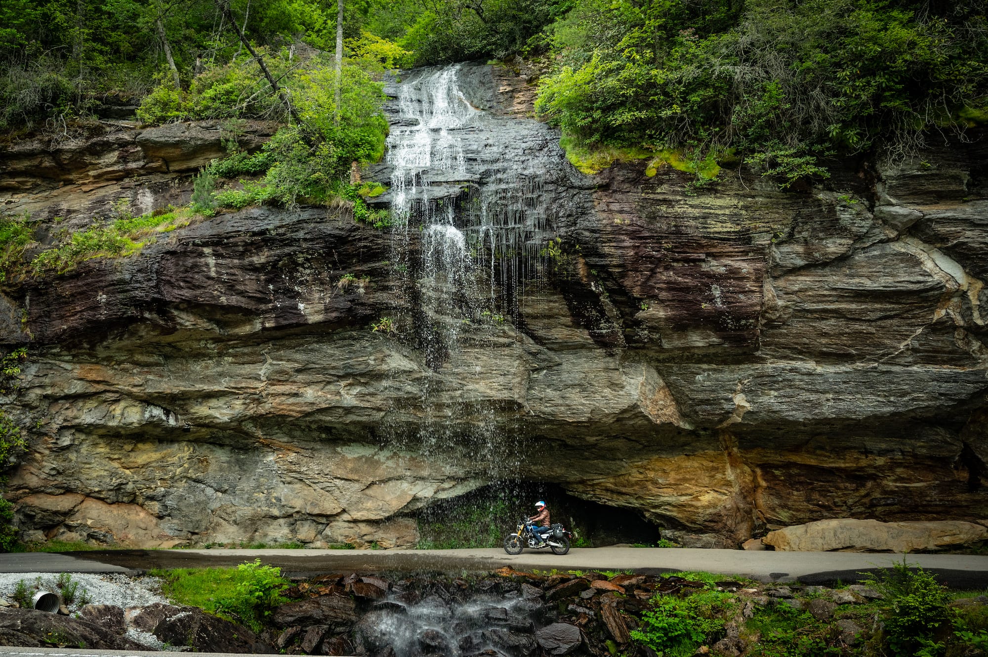
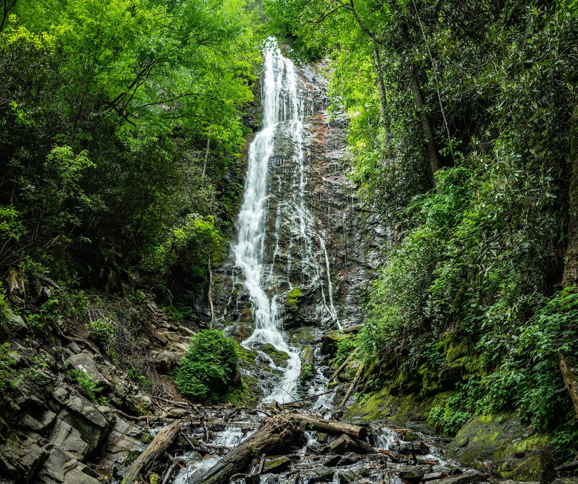
The first waterfall we hit was Sequoyah Falls, which flows over the dam at Lake Sequoyah. Bridal Veil Falls had more than a trickle flowing over it when we passed through, and Dry Falls was anything but dry. In fact, it might have been the biggest waterfall we visited.
We followed US 64 north, until we reached Wayah Rd, one of my favorites. The switchback corners here are exhilarating and the pavement is generally in very good shape. We opted for another short 4.4-mile gravel detour and headed toward Wayah Bald, ending up in the clouds once again. Many of the trees at the top are dead from a forest fire and they looked like something out of a Halloween movie when swallowed by the low fog.
After leaving Wayah Bald, we set off for Tellico Gap, which connects Wayah Rd and the northern section of SR 28 where fast sweeping corners cut through dense kudzu overgrowth. This is another one of my favorite roads in the area. Tellico Gap has nearly six miles of gravel as it traverses the mountain pass. The surface is loose and deeper in some spots than others. The three of us were on street bikes with slick tires and we took our time enjoying the ride and the beautiful view as we crossed the Appalachian Trail. It was at this point in the route that I thought to myself how lucky we were to be traveling with riders who have such an adventurous spirit.
The rest of the route was paved, as intended, and several more stops at waterfalls meant we didn’t get back to Maggie Valley until after 7:30 p.m. A late dinner, followed by a couple of beers and a campfire, were the perfect cap to a great day on two wheels.
Sassafras
The sassafras tree is native to southern Appalachia. The roots and leaves are used for medicinal purposes and have a slight licorice taste to them. Take its roots and boil them along with a little molasses and you get the spiced syrup used to make root beer. Back in the day, the syrup was fermented, and root beer got its name from this combo of fermenting roots. Nowadays, the syrup is mixed with soda water and served to the whole family. If you know what to look for, you can spot sassafras trees all over the southeast. In fact, I have some growing in my backyard right now—maybe I should make some homemade root beer?
From Maggie Valley, we rode to the south, keeping our eyes peeled for “mitten leaves” as they are sometimes referred to. Every time we spotted one (or thought we spotted one, more likely) we would call out “sassss-a-frassss” through the Cardo communicators. This game lasted the entire day and made for many laughs as we rode.
We turned off of SR 107 onto Tilley Creek/Ellijay Rd, a very narrow paved road that goes over the mountain and right through Sassafras Gap. The pavement was broken in spots and the corners were tight, which kept us on our toes. As we carved our way through the gap road, we came to the conclusion that this just might be one of our favorite roads in all of North Carolina. For a moment, we pondered what it would take to relocate the RoadRUNNER headquarters to the top of this mountain. Barring any issues with internet access and cell phone reception, the idea may still be on the table. We’ll have to discuss this again in our next staff meeting.
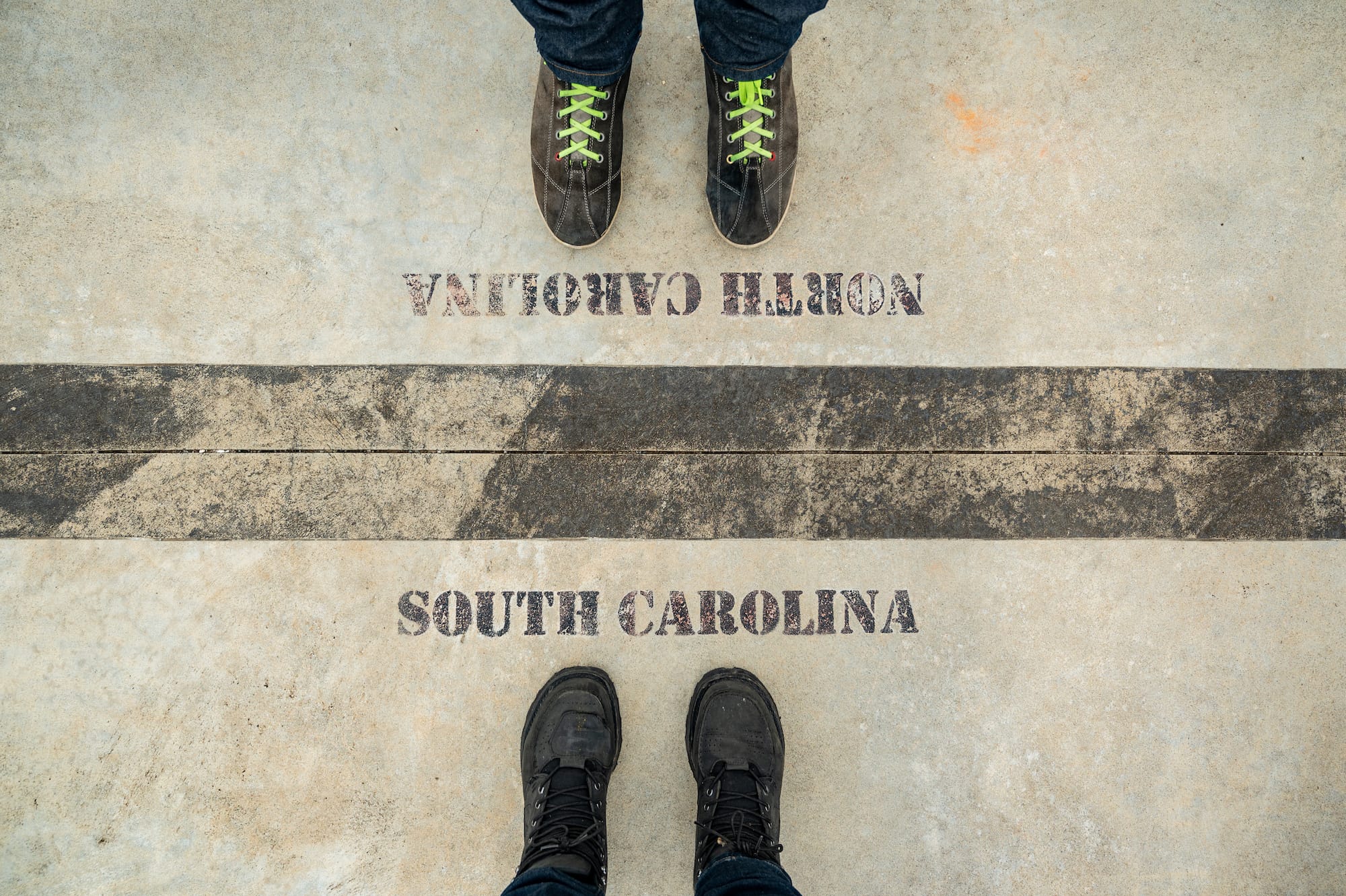
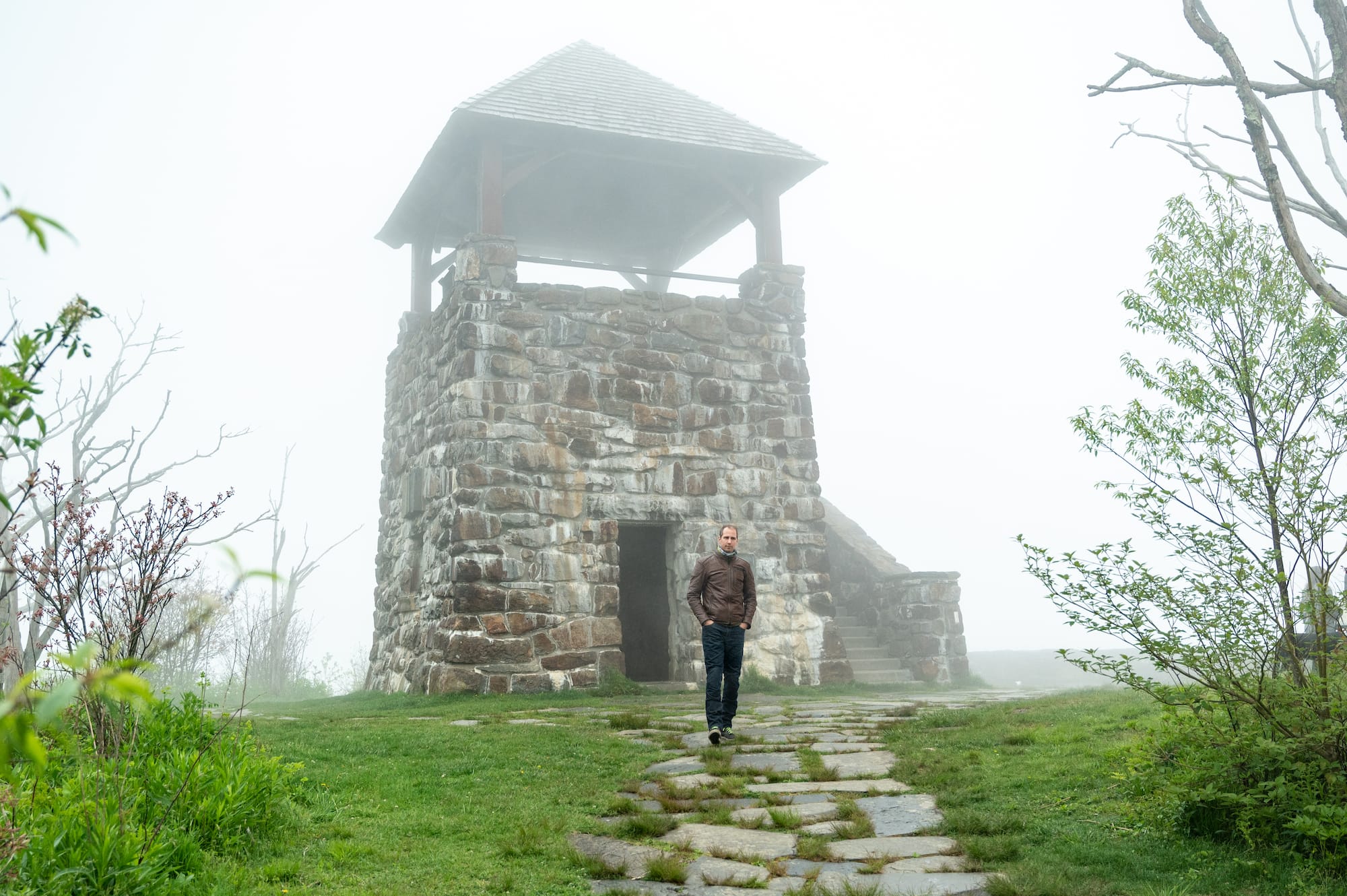
Following US 178 south of Rosman, we dipped into South Carolina for just a few miles before turning left on Sassafras Mountain Rd, another new experience for all of us. At the top of Sassafras Mountain is an observation tower which straddles the North-South Carolina line, marking the highest point in South Carolina.
Toward the end of the day, we stopped at Rocky’s Soda Shop in Brevard for a late-afternoon sweet treat. As you might have already guessed, we ordered root beer floats.
Wheels Through Time
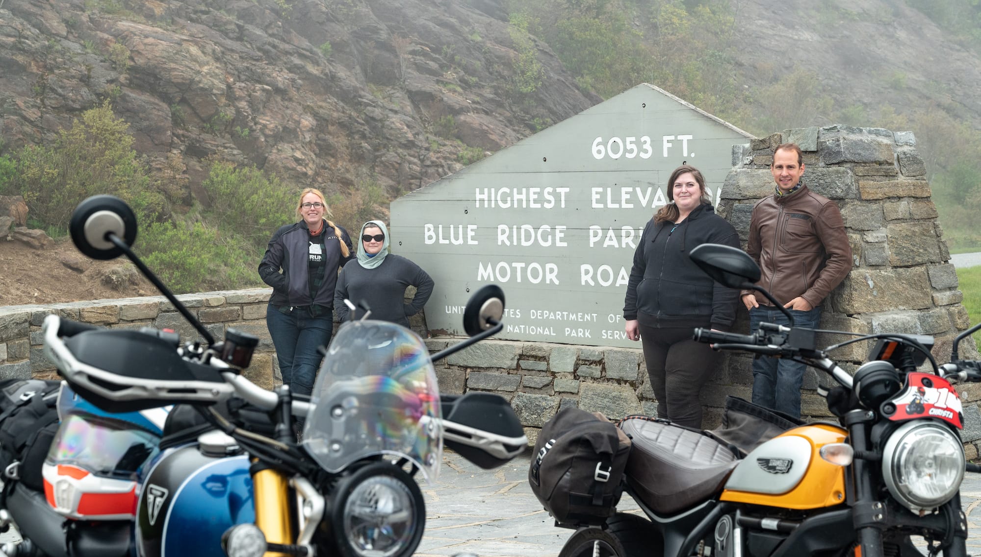
On the last day of the tour, we woke early and headed toward the Blue Ridge Parkway. In the clouds once again, we enjoyed a short jaunt over to Hwy 215 and then across Pisgah Hwy. We had the road to ourselves and stopped a few times to take photos. The ride was peaceful and calming, as if we were actually flying in the sky through the clouds.
Concluding our tour was a quick three-hour visit to the Wheels Through Time Museum. I don’t think we could have seen everything if we spent three days there, but we did our best to view the highlights and move along. By now, I think most motorcyclists have heard of the museum and its devoted director, Dale, who passed away just a few years ago. The family has done a tremendous job filling his shoes, and I believe Dale would be proud to see how things have turned out. If you’ve never visited the museum, put it on the top of your riding to-do list. I’ve already planned a time to go back for a second visit.
Knees In The Breeze, Wenus In The Wind
When traveling with friends, especially ones you allow to join your communication channel—an honor bestowed only upon the most worthy of candidates, mind you—you always end up with a slew of jokes that stick with the group throughout the trip. You know, the ones that make you laugh from the deepest part of your diaphragm.
On this particular trip, the loose skin covering your elbow joint became the running gag. The slang term for such loose skin is “wenus” or “wenis,” used interchangeably. Have you ever noticed how stretchy it is? Go ahead and test it out. Take your fingers and pinch the skin at your elbow, then pull. Some people have a large one, some are small, some are growers, and some are showers. Ah, there it is. I’m chuckling again.
As riders, we have sayings that only other moto maniacs understand, often referring to the sensations of riding a motorcycle. Sometimes we use these phrases to tease or motivate other riders. Other times, they are parting phrases to wish someone a nice or safe ride.
Keep the shiny side up. Rubber side down. Grab life by the handlebar. When in doubt, throttle out. The list goes on. Now you have a new one to share with your riding friends. So, next time you’re embarking on a fun RoadRUNNER Shamrock Tour…
Keep your knees in the breeze and your wenus in the wind.
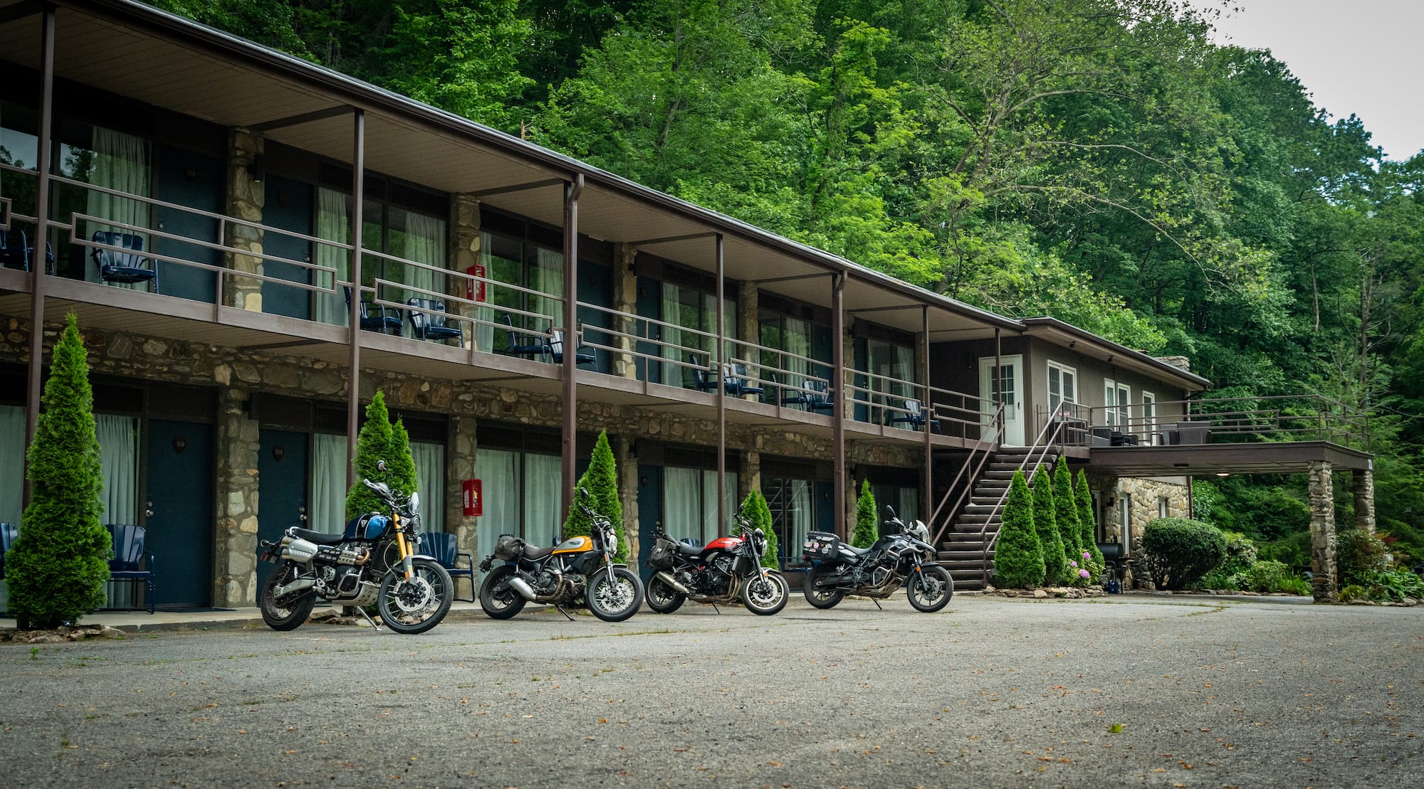
Lodging: Heart of the Valley Motel
Heart of the Valley Motel is a creekside motel located on the main strip in Maggie Valley, but you wouldn’t know it by simply walking out of your room. Heart of the Valley is tucked away off the road, surrounded by forest and mountains. The rooms are spacious and newly renovated. And the best part? The owners are riders too. Ask them about their bikes and they’ll be happy to tell you stories while relaxing around a campfire after a long day in the saddle. Find it at 73 Heart Ln, Maggie Valley, NC, (828) 400-0700.
Shamrock Tour: Behind the Scenes
A lot of preparation goes into creating the tours you read about in RoadRUNNER before we ever ride them. From hours of scouring maps for the perfect roads we’ve never ridden before to finding the best hotels, attractions, and restaurants—we carefully consider where we go and what we do. Often, it’s a challenge to find the right balance between what we want to do on a tour and what our readers would want to read about or do on their own tour.
Then there is the documentation aspect. Where do we stop to take photos? How many times do we stop throughout the day to note down what is happening? Do we tell people why we are visiting their establishment or do we act like a secret shopper to get a genuine experience? The real answer is, it depends. Every trip is a little different, and each tour requires a slightly different approach.
“I enjoyed getting to see the process of creating magazine content! Viewing locations and scenery not just from a rider’s singular perspective, but also with the goal of sharing these experiences with others was fascinating. It’s satisfying to see the work that goes into other industries and products. It creates a greater appreciation for the stories we routinely enjoy.” —Christina Stephens
Facts & Info
Approximately 680 miles
Overview
Western North Carolina is one of our favorite regions to ride (there’s a reason the RoadRUNNER headquarters is in NC) and Maggie Valley makes for the perfect Shamrock Tour home base. The town is located near hundreds of miles of fantastic twisty paved and dirt roads alike, and sits only a few miles from the Blue Ridge Parkway. Along the Maggie Valley strip, you will find plenty of restaurants serving delicious food, convenience stores, and souvenir shops to pick up a trinket to take home with you. We suggest traveling in the swing seasons to avoid crowds and traffic.
Roads & Riding
Most of these routes are paved and include some sections of open highway, alongside lots of quick twisties. As mentioned in the story, there are a few sections of gravel. Hwy 32 at the northern end of Great Smoky Mountain National Park has one mile of easyto-navigate gravel at the end of a long and fun paved section. We recommend riding this part of the route as-is.
The entrance to Cataloochee Valley includes 2.8 miles of gravel, and the road to Wayah Bald has 4.4 miles of gravel. Both of these are optional out-and-back detours you can easily skip if necessary.
Tellico Gap includes 5.6 miles of gravel road to get over the mountain, but it can be done on any bike if you take your time. However, riders on larger street bikes who aren’t comfortable on gravel may want to skip this section and instead continue north to Hwy 74. But if you’re up for an adventure, the views are worth it.
Resources
Visit Haywood County
Visit Maggie Valley
Visit NC Smokies
Area Highlights
• Dry Falls
• Ellijay Rd
• Rocky’s Soda Shop
• Blue Ridge Parkway
• Sassafras Mountain Observation Tower