Santa Fe, New Mexico Shamrock Tour®—Tumbleweeds to Snowflakes

As I arrived in Santa Fe, NM, I texted Ryan Cook, the artist of the Kickstand Comics featured in RoadRUNNER. Florian put us in touch, as a local resource is always handy when visiting new places. “Make sure to try the famous ‘Chimi’ from our local gas station chain, Allsup’s,” he told me. Marching orders received.
The white-and-red sign greeted me as the smell of gasoline and hot food took over. The burritos were delicious and warm. I was a bit chilly, as Santa Fe (the highest state capital in the U.S.) is at nearly 7,000 feet of elevation. It’s situated right at the base of the Sangre de Cristo foothills, surrounded by views of mountain peaks well over 12,000 feet tall.
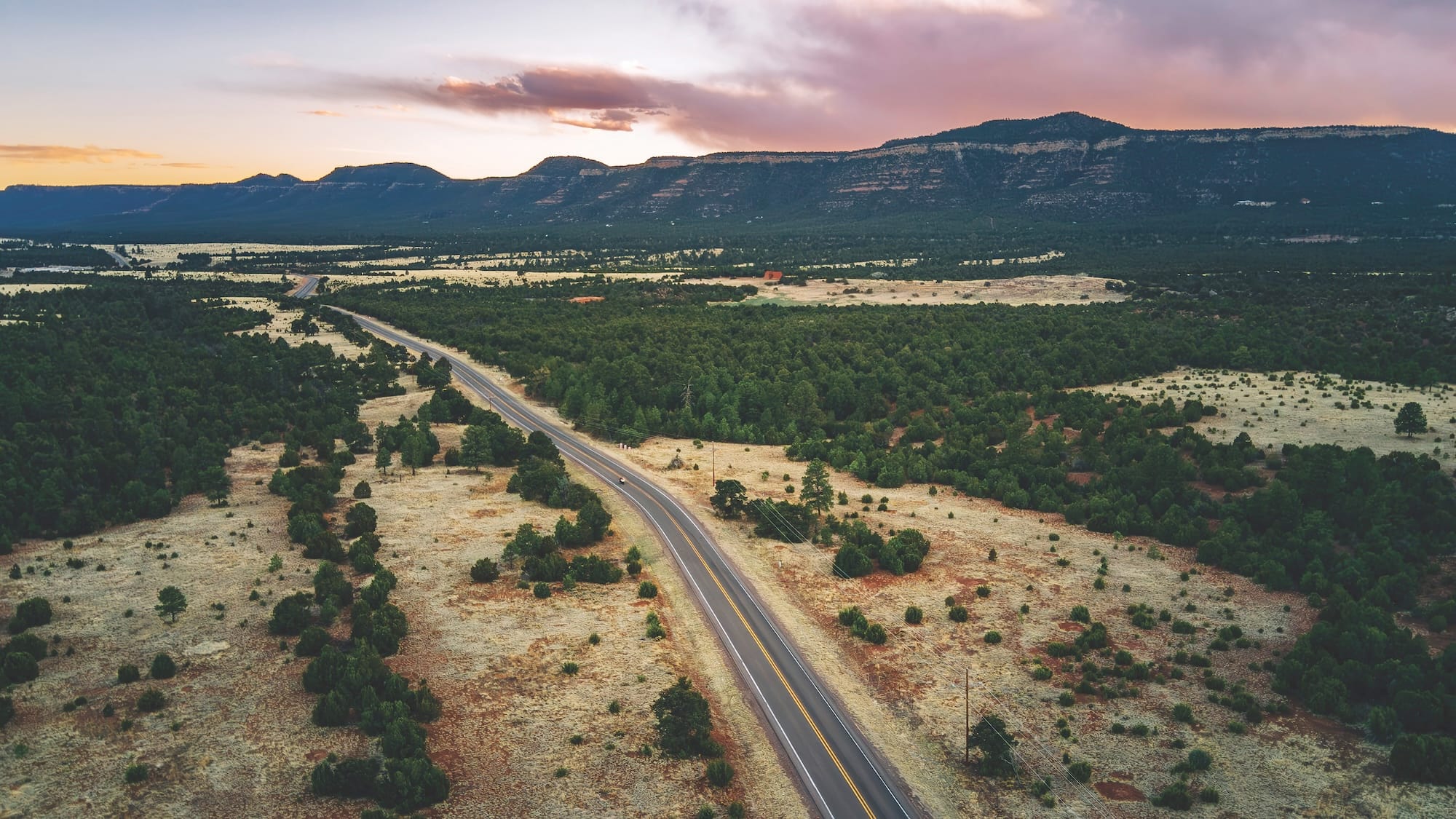
The city is often mistaken for a high desert. My ride into town was super windy as I passed through barren flatlands. The cacti, roadrunners, and tumbleweeds across the brown landscape would have convinced me of this being a desert. But this region of northern New Mexico is, in fact, semi-arid and technically a steppe climate. That only means this area receives just enough rain to surpass desert classification. The more I explored, the more it came to life.
Between 1926 to 1937, Route 66 officially ran through Santa Fe, but the Mother Road was realigned soon after. Barely anything of it remains, but the avenues still have a feeling of nostalgia. I followed some flickering lights in the distance to a motel. An old, large, half-neon and half-incandescent sign towered over the road and read “Kings Rest Court Inn.” Perfect—especially as I was on a Gold Wing.
Motorcycle & Gear
2025 Honda Gold Wing 50th Anniversary Edition DCT
Helmet: Bell Custom 500
Jacket & Pants: Carhartt
Gear: Klim Tactical Long Sleeve, Klim Tactical Pants
Boots: Sureway Composite Work Boots
Gloves: Work Gloves
Luggage: Honda OEM bags and trunk
Camera: Leica Q
The Original Las Vegas
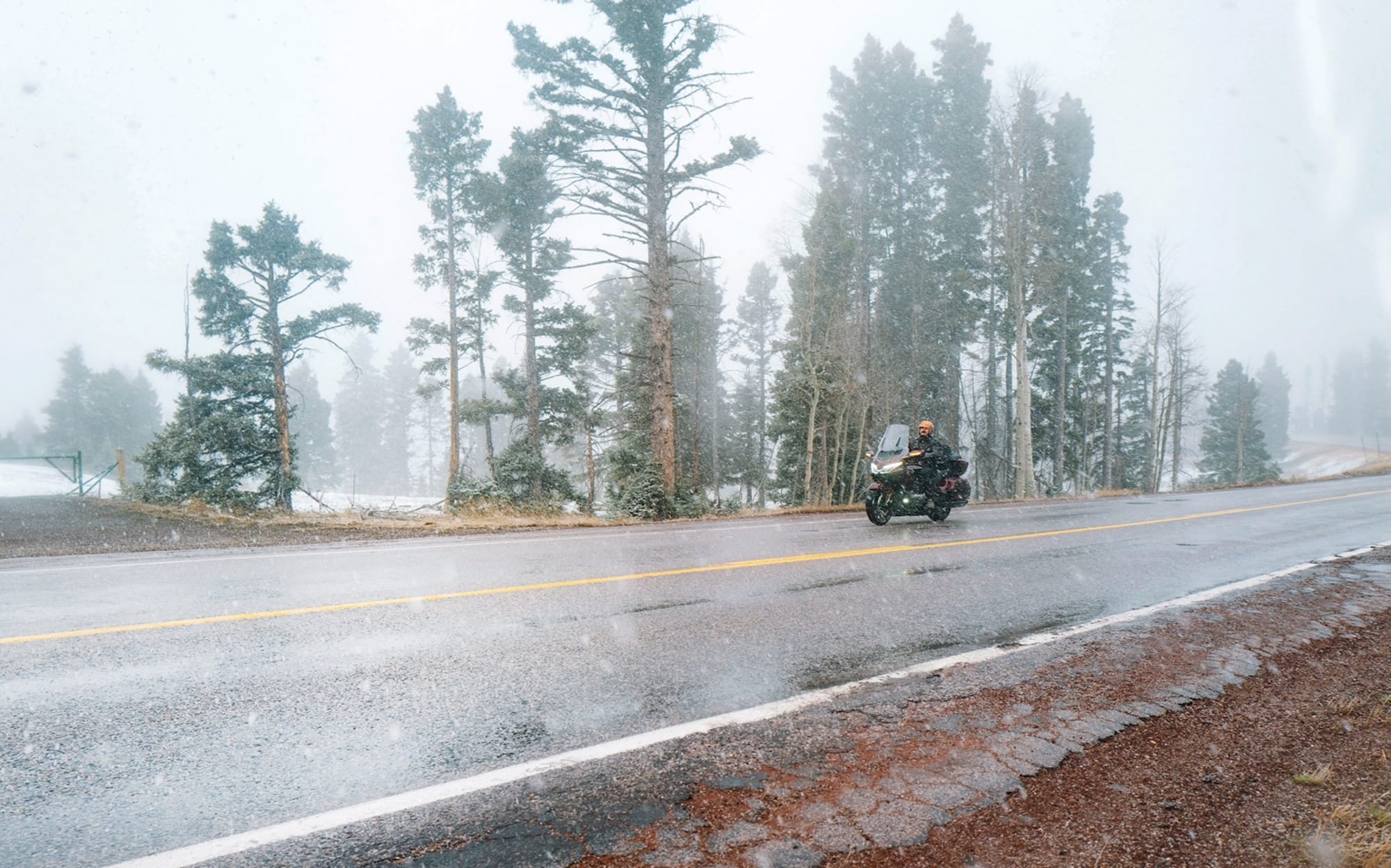
It was a cold morning, but I was warm with my heated grips and seat. The sun was just cresting over the eastern mountains as I got rolling. In a way, I’m old school—says the 30-year-old riding a brand new Gold Wing. To be fair, I do have a 1982 GL 1100 Aspencade at home, fully bagged from the Honda factory with special-edition paint, air ride, a radio, and even a vanity mirror in the trunk. The feel between these two bikes was surprisingly similar, even with more than four decades of engineering between them. It just goes to show that Honda nailed it long ago. Although the new Wing was fitted with a digital display and Apple CarPlay, I was much more at home picking up a paper map to guide my travels.
Signs for Old Las Vegas Hwy led me east out of Santa Fe in search of coffee. This route runs parallel to I-25, but offers a much better two-lane experience. It twists and turns around Thompson Peak, one of the southernmost peaks of the Rocky Mountains. The road was also part of the original Route 66, taking you from Santa Fe to Pecos, Bernal, and Romeroville before ending just south of Las Vegas (not the one with the Strip). The only remnants of the Mother Road are tattered historical markers and fading signs.