Southern Minnesota
Even though Minnesota lies halfway between the east and west coasts, it's not one of the dry prairie states. Millions of years ago, retreating glaciers took care of that, leaving more than 15,000 lakes behind. So, there's always water around the corner. Apart from that there is the Mississippi River Valley, cradling the state's most scenic highway, its beautiful river towns, and the exciting curves in the ravines and valleys of the bluffs in the southern region of the state.
Day 1: Mississippi Bluffs
Dark clouds hang over Rochester and intermittent showers fall as we close in on the city. It's only 6 p.m. but it looks like midnight. Wet, tired and hungry, we finally check in at the Hampton Inn where the desk clerk says the next day's forecast calls for more of the same. Fortunately, he's wrong: The morning dawns with sunshine and blue skies all around!

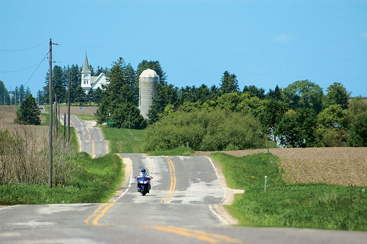
In Stewartville, we turn left on Highway 30 and leave all the traffic behind us for an enjoyable ride through the countryside. East, past Chatfield, we come upon some hills and curves that make the ride on Highway 6 even more pleasurable. I could have been having so much fun on the Gold Wing that I wasn't paying attention or maybe the map wasn't accurate enough, but somehow we left 6 and got back on Highway 30. Seems we missed a turn to the right. Instead of heading for Lewiston and Winona, we're approaching Rushford. It's too late to double back; so, we continue north on Highway 43, right across the bluffs, into southeast Minnesota, the only mountainous part of the state.
Descending from the ridge, we eventually drive into Winona, a city of 30,000 that's enclosed on three sides by the waters of the Mississippi River. People on Harleys and others in boats seem to be having a fine time puttering about on a Sunday afternoon. "It's the first nice day after weeks of rain," the friendly lady at the visitor center says, explaining the crowds.
After circling through the sleepy city, we drive up to the scenic overlook on Garvin Heights for a spectacular view of Winona and the Mississippi. As we prepare to leave, a stranger approaches and hands us two Minnesota maps. "I think they'll do you some good," he says and then disappears. Well, thanks, sir - what a nice surprise!

Following Highway 17 up into the mountains offers some nice curves, and we ride eastward parallel to I-90 until descending toward the mighty river again. For a couple of miles we let it roll on, enjoying great views of the Mississippi from The Great River Road (Hwy 61), often described as one of the most scenic drives in the U.S.
Two miles past La Crescent, we turn away from the river. Staying on Scenic Highway 16, we follow the Root River through hilly farmland until we return to Rushford, a regional crossroads where bikers are coming at us from all directions. During our coffee break at the gas station, a couple on a black Gold Wing rolls up to chat. Obviously, we're not from around here, and they thank us for bringing some nice weather for a change. The woman adds, "I hope you're planning to stay awhile!"
From Rushford on, Highway 16 becomes even more beautiful in the Root River Valley, which seems to be the place to be for a weekend off. There are quite a few bikes on the road and lots of canoes in the water. It's late afternoon when we get to Lanesboro and slow the pace. Filled with nice examples of nineteenth-century architecture and, on this particular weekend, bicycle riders, the town is located along the 42-mile-long Root River Bike Trail.

Many people in this region come from German stock, so it almost feels like we're coming home when we step inside Lanesboro's "Das Wurst Haus" (the sausage house) where they sell their own tasty brands of German meats, sausages, bread and even root beer. A pound or two heavier, we wander on westward into the evening sun, passing by woods, and cattle nodding in the fields.
Reaching Preston, it turns out there's no way for us to make a left turn onto Highway 14. It just doesn't exist. We follow Highway 12 instead, which splits up into 12 and 14 after a few miles, and the map the stranger in Winona gave us really proves helpful. Once on Highway 14, we continue westward, reach Highway 63 again, and roll back into Rochester.