Shamrock Tour® - Ashland, Oregon

On November 27, 1941, travelers on US Highway 99 south of Yreka, Caifornia were astonished to find a band of men blocking the road and waving hunting rifles. They handed out a Proclamation of Independence, which informed one and all that the State of Jefferson was in "patriotic rebellion against the States of California and Oregon" and would continue to "secede every Thursday until further notice..."
But in spite of having gone to the trouble of inaugurating John C. Childs of Yreka as the chief executive of their new State of Jefferson, the secession movement lasted just two weeks. On December 7, 1941, attention turned to Pearl Harbor and the conflict in the Pacific.
One of the least populated and last settled areas on the continent, the counties of the Klamath, Smith and Rogue River watersheds on the Oregon-California border have long believed themselves hard done by. An earlier proposal for a State of Jefferson lost out to the establishment of the State of Oregon in 1859, and the 1941 "secession" sprang from the apparent indifference of the governing bodies in Salem and Sacramento to the condition of Jefferson's roads. Ironically, World War II did more to improve infrastructure than the "secession," but the idea of a State of Jefferson persists - thanks mainly to the region's NPR station, Jefferson Public Radio, based at Southern Oregon University.

Arrival in Ashland from the south on I-5 follows a sweeping descent from the 4,300-ft Siskiyou Summit, on one of the Interstate system's steepest grades. Topographically, Ashland nestles in a narrow rift between the Coast and Cascade Ranges, which squeeze together near the OR-CA border. To the west are the forested peaks and passes of the Siskiyou Mountains, and in the east, the (mostly) dormant volcanoes of the Pacific Ring of Fire.
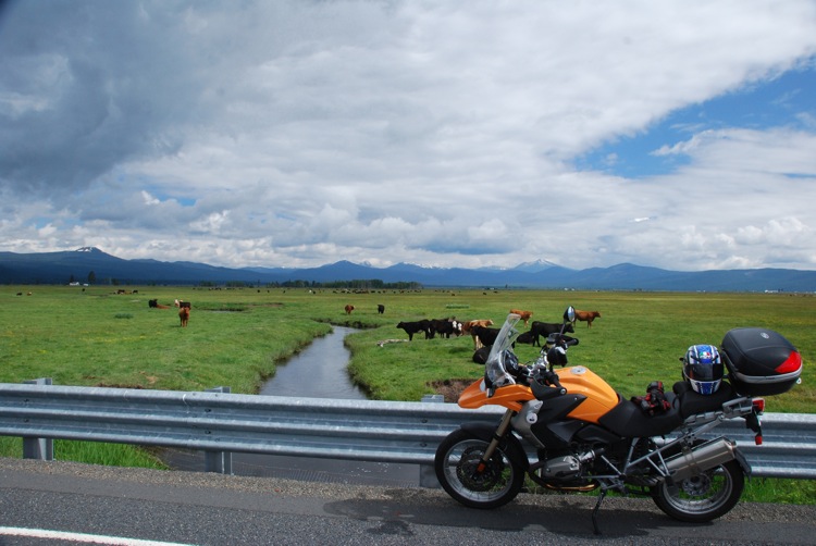
Motorcycle & Gear
2008 BMW R 1200 GS
Helmet: AGV Stealth
Jacket: Tour Master Epic
Pants: Tour Master Flex
Boots: Held Via
Gloves: Fieldsheer Attack
In addition to the four-year public university of SOU, Ashland's intellectual climate is enriched by its annual Shakespeare Festival, which runs during most of the summer. Street performers gather to display their skills in downtown Lithia Park, musicians practice on street corners, and the town displays a generally festive air with all the banners fluttering, window decorations touting the event, and the customer overflow in the cafés spilling out on the street. It's all quite agreeable.
Based here for the next four days to ride some of the best roads in "Jefferson," with my home away from home at the Ashland Springs Hotel, the city's grande dame, which is easily the tallest downtown building at eight stories, I'm riding BMW's jack-of-all-trades R 1200 GS, rented from Dubbelju Motorcycle Rentals in San Francisco. And since I'm going to be here while the festival's on, I may even take in one of the bard's plays too!
Day 1: Roads to Nowhere
"Historic" Highway 99 predates Interstate 5 in these parts, connecting the towns of the Rogue Valley rather than bypassing them. So I ride the 13 miles from Ashland to Medford on 99, past the dollar stores, liquor outlets and gas stations of Talent and Phoenix before turning north in Medford on Table Rock Road, which sits, as its name suggests, on a flat-topped pile thrust up from the surrounding plain. Transmission towers and power lines spoil its dramatic effect, however. Then Meadow Road leads me to East Evans Creek Road, and it's here some GPS issues arise. I'm trying not to use maps, but the Zumo steers me onto a private road with a locked gate… Soon after, I arrive in tiny Wimer and admire its charming restored covered bridge.
My route should take me to Sunny Valley, 15 miles or so west. The Zumo guides me to Queens Branch Road, which quickly turns to gravel as it climbs. Close to the summit, the road peters out, and all that's left is a muddy trail with axle-deep ruts and gulleys that could swallow the whole bike. I head back to Wimer and its garrulous gas station attendant. "You want Ditch Creek Road," he says. So I try again. I can't find Ditch Creek, but I do find Dixie Gulch. It must have been what he meant… This time at the summit, there are four alternatives: another mud trail, two gravel trails and the entrance to an ad hoc logging camp with a growling Rottweiler and "trespasssers will be shot" signs. Every which way, the Zumo says "Off route. Recalculate?" If Ditch Creek exists, I didn't find it.
I retreat to Rogue River City and cruise I-5 to Sunny Valley, turning west on Monument Drive, past the heritage town of Pottsville. After retiring in 1959, Eugene "Debbs" Potts, a former mayor of Grants Pass, created his own "town" on 30 acres he owned near Merlin. Without the signboard, I might have dismissed it as yet another farmyard full of rusting machinery, but Pottsville actually contains many significant historical artifacts, such as a 1911 Case steam tractor and a siren that once sounded from a horse-drawn fire truck during the 1906 San Francisco earthquake.