Trails Across Wyoming
If Route 66 is the "Mother Road," then Highway 26 could lay claim to "Grand-Mother" status: it runs from the heart of the Great Plains, across the Continental Divide, and through the Cascade Mountains to Seaside, Oregon.
Originating near the confluence of the North and South Platte Rivers, in Ogallala, NE, Highway 26 follows the Mormon, California, Oregon, and Pony Express trails across Wyoming, before branching northwest toward Idaho, and ending 1,500 miles away at the Pacific Ocean close to Astoria, OR. Astoria, you may know, is the location of the trading outpost established by John Jacob Astor's expedition of 1811, which ultimately secured the Oregon Territory for the fledgling Union.
Scottsbluff, with just 14,000 people, is the most populous city that Hwy 26 travels through in Nebraska, and it's the starting point for my ride to Jackson, Wyoming. The previous day, I rode from North Platte through Ogallala, past one of the most famous monuments on the Oregon Trail. Chimney Rock's spindly spire, though it rises just 300 feet above the plain, tops out at more than 4,200 feet above sea level.

I'm staying at the Candlelight Inn, a quirky motel just outside Scottsbluff. My room features early thrift-store style, with a scattering of plush toys, lace doilies, ancient books, and embroidered lampshades; but it's cozy and comfortable. When I checked in the previous evening, the elderly gentleman behind the counter insisted that I try their complimentary breakfast before leaving. Years of staying in chain motels have left me wary of free breakfasts, but the Candlelight's is every bit as good as the recommendation, and then some. When I step into the dining room, I find a smorgasbord of hot entrees including biscuits and sausage gravy, hash browns, O'Brien potatoes, frittata, eggs-every-which-way, fruit, cereals, toast, bagels, a bottomless coffee pot - and all obviously homemade! Utensils look like they're from the same source as my room furnishings, and I choose from a randomly mismatched stack on the counter.
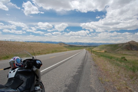
Motorcycle & Gear
2007 BMW R 1200 RT
Helmet: Nolan N84 N-Com Celtic
Jacket: Held Taigami
Pants: Held Nelix
Boots: Held Via
Gloves: Held Sprint
Reminding myself that breakfast is the most important meal of the day, I significantly decrease the buffet offerings before climbing aboard my rented BMW R 1200 RT. Strangely, the gas tank seems to have moved closer to my stomach since yesterday. Since I'm already on 26, navigating my trip to Jackson in the Teton Mountains will be easy, as I just follow 26 all the way. It's mid-June, and while temperatures can top 100 degrees on the plains this time of year, I'm also climbing to 10,000 ft, so a three-season shower-proof suit seems like the best option.
Rails Along Trails
The first few miles are very Nebraska. I ride a straight, two-lane road across flat, open grassland, alongside a railroad chock full of mile-long coal trains heading east from the great coalfields around Gillette, WY. Fort Laramie is my first stop. I pay my $ 3 and park next to the remains of the fort's hospital, now just a shell of a brick building. The other wooden edifices, presumably the barracks and officers' residences, all seem well maintained and heavily coated in maroon paint, though none are open for visitors.

Nearby is the marvelous 1875 trussed iron bridge over the North Platte, now listed in the National Registry of Historic Places. It seems the North Platte was somewhat more ferocious than the lazy stream that now drifts under the old bridge, and it created a significant barrier to travelers. Current demand for irrigation water has stifled its flow, and the three 140-foot spans (prefabricated by the King Iron Bridge company of Cleveland, OH and hauled from Cheyenne, WY by ox cart) now dwarf the river. Apparently, the crossing opened up a new and important route from Cheyenne to the gold fields around Deadwood, so the sign says. It seems odd that this narrow and fragile-looking structure could have made such a difference to the transportation infrastructure in these parts, especially as late as 1875.