Reader Ride: Pony Express Trail

“WANTED: Young, skinny, wiry fellows not over eighteen. Must be expert riders, willing to risk death daily.” I meet none of the prerequisites to qualify for this trip as the 1860 handbill advertised. Yet I’m intrigued by the history of the Pony Express Trail and reckon it’s as good a way as any to get to California.
Trip planning begins with an internet search and buying a couple of Pony Express books. There is a published auto tour route that sticks to paved roads, but there is also an unpaved section, mostly in Utah and Nevada. The route somewhat follows the trail and passes near the 184 relay stations spaced about 10-15 miles apart along the 2,000-mile trail covering eight states. I find out that most of the relay stations are long gone and build my trip around those that remain.
My starting point is the Pony Express Museum in St. Joseph, MO, where the original stables were in 1860. There is a ferry no more, so I head west on Highway 36 atop my 2007 R 1200 GS Adventure and cross the bridge over the Missouri River into Kansas. This is a good road with minimal traffic even in the summer, and I pass the occasional big iron cutout of a Pony Express rider silhouetted on the hills along the highway. In Marysville I encounter my second life-size bronze Pony Express statue. Turning north, I stop at a rare Pony Express station at the Hollenberg ranch before entering Nebraska.
The auto tour route sort of zig-zags through small towns to the northwest until it intersects with I-80 midway across Nebraska. After 95-degree temperatures, intermittent steamy showers, and playing dodge with trucks going 80 mph, I finally exit at Gothenburg to check out another restored Pony Express station. Today you can mail one ounce anywhere for 47 cents. The Pony Express initially charged for a half-ounce. It’s getting late in the day and my goal is to make it to Colorado, so I forgo taking the pleasant two-lane that parallels I-80 and speed through more stressful, heavy traffic and rain on the interstate. I make camp right across the street from the Julesburg, CO, rest area that has yet another life-size bronze statue of a Pony Express rider.

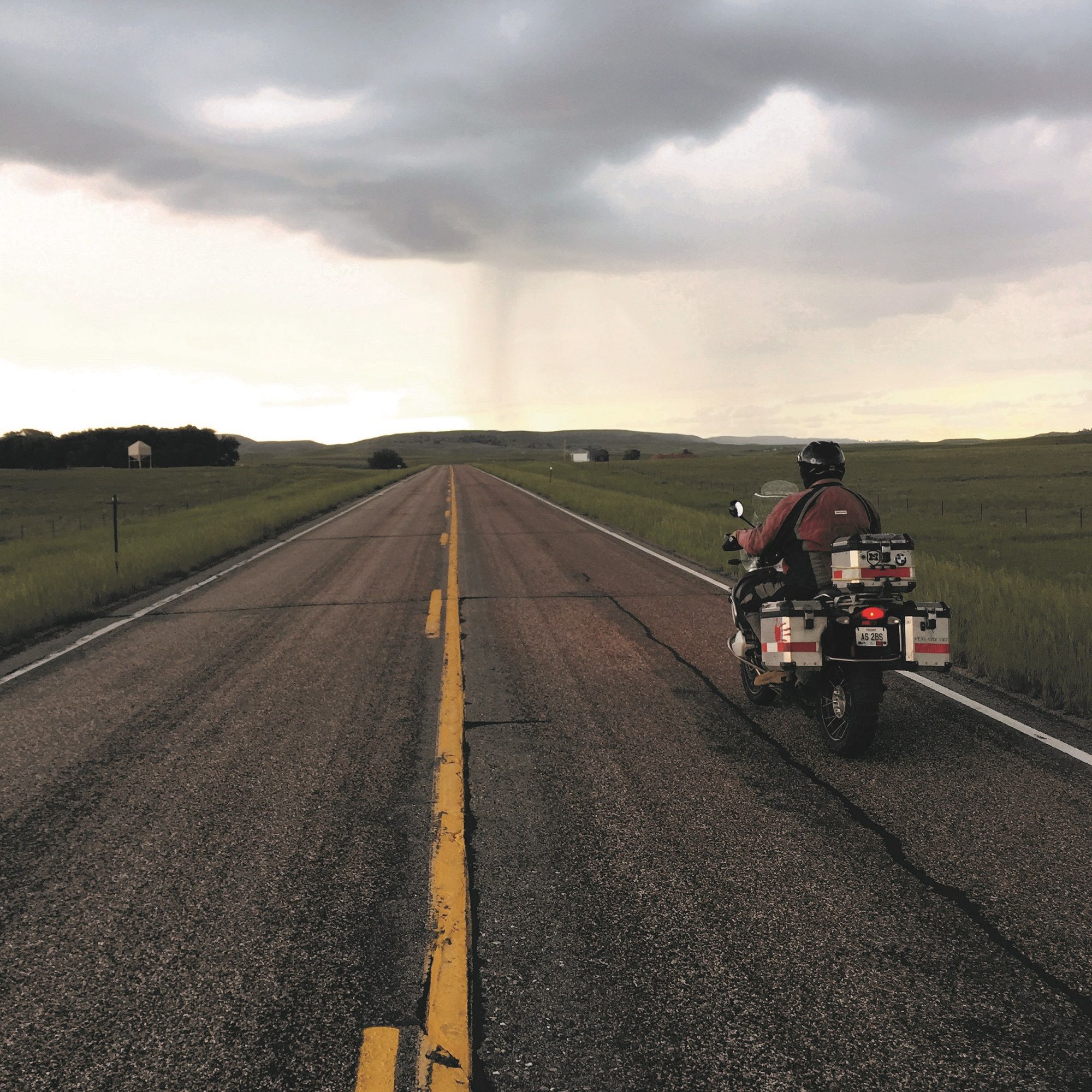
Making a rookie mistake and not pegging down my tent has me struggling to batten down the hatches in the dark as brief bursts of wind and rain advance across the plains. I’m up at sunrise, the weather has cleared, and the temperature’s comfortable as I leave the torments of I-80 and take relaxed two-lanes with almost no traffic out of Colorado and return to Nebraska. I follow my travel instincts and stop in Gurley at a small roadside cafe that has the obvious local clientele vehicles parked surrounding it like circling the wagons. Soon the flat, treeless plains and wide-open skies are pierced by Chimney Rock National Monument, a prominent marker for many of those who traveled west. Be sure to stay on Highway 32 through Scotts Bluff National Monument—awesome vistas. Continuing to follow the flat North Platte River Valley, with an occasional pheasant crossing the road and a collision with a red-winged blackbird, leads me into Wyoming with a quick stop at the Fort Laramie National Historic Site. Then it’s off again as ahead I see foreboding, sooty clouds sprinkled with bolts of earthbound lightning. Fortunately, the lightning misses me, but the rain and wind do not. Why the Pony Express Trail went so far north is a mystery, but with the vast expanses of Wyoming behind me I eventually get back south and onto I-80 again, this time with much less traffic.
After spending the night with a friend in Salt Lake City, I break away from paved roads and the auto tour route in Faust, UT, on Highway 36 to continue along the more traditional route the Pony Express followed. If you decide to go this way, you better have plenty of water and fuel, because it is very remote with no services for about 200 miles, and in June when I went it got up to 105 degrees. Expect sections of soft sand and rough washboard gravel. There is pretty much nothing out there, but in several places a short hike into the sagebrush will lead you to a Pony Express marker that is so lonesome you wonder who or how it got placed there. The end of this day has me in Ely, NV, at a KOA, overheated, exhausted, and just glad to have survived. I have no idea how they got water to the stops along this stretch or how the riders and horses could cross such challenging terrain, but those were some tough individuals and the youngest was 11.

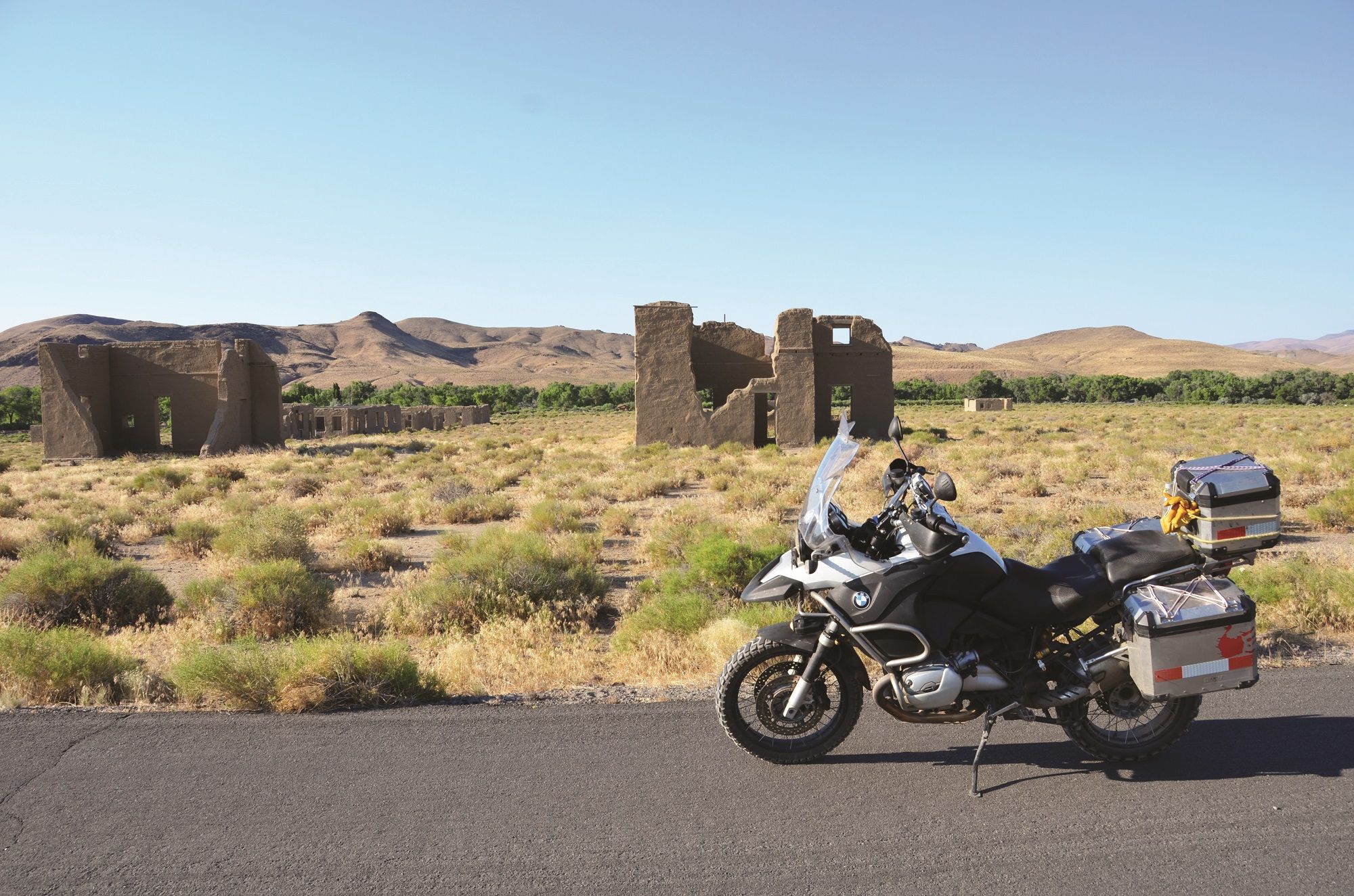
I’m heading west on pavement again. This time on Nevada Highway 50, dubbed “the Loneliest Road in America,” with its far-reaching views of nothing. There are several old Pony Express ruins to stop and look at, as well as places like Middlegate Station a few hundred yards south of the highway—great food and a spot not to be missed, with cold drinks to quench the hairdryer-in-your-face 100-degree winds. I was looking for the Loneliest Phone Booth in America near Sand Mountain Recreational Area only to find it is no longer there due to it being used for target practice by bored travelers. There is a marker here for the Sand Springs Pony Express Station. On down the road and about 500 yards north of the highway you can see the ruins of Hawes Station, but getting there is an adventure in itself. At Silver Springs I take a short detour south to camp at Fort Churchill State Historic Park. There is a small museum as well as some ruins, and nearby is Buckland Station.
Up again with the sun I try to take the dirt/gravel Fort Churchill Road toward the town of Fort Churchill, but after a couple miles of five-mph rutted terror I turn back and take the pavement. At Fort Churchill I take Six Mile Canyon Road, which snakes through the canyons west to Virginia City. You won’t be disappointed by it. Virginia City is a touristy but cool town with many nice restaurants. I take the curvy route out of Virginia City back to Highway 50 and then west, skirting the eastern edge of Lake Tahoe. It is here that I pass by yet another life-size statue of a Pony Express rider perched outside Harrah’s Casino.