Nebraska Outlaw Trail

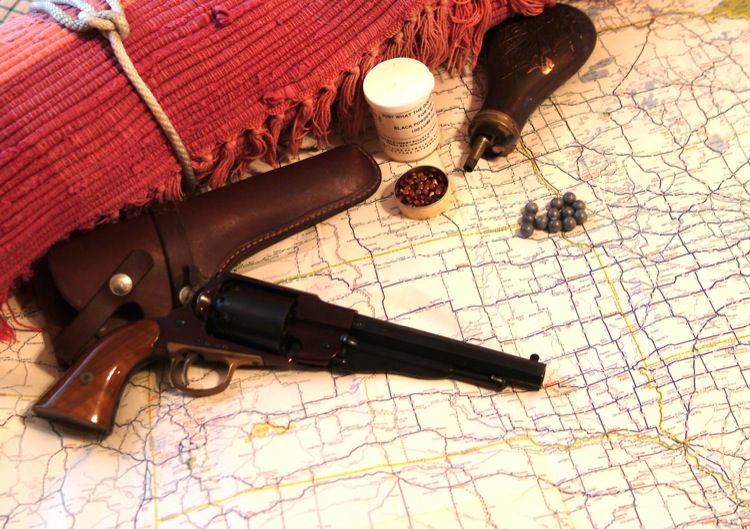
What motorcyclist doesn't feel a kinship with America's cowboys? Our bikes have saddles, not seats. We use saddlebags for storage, not a trunk. And, of course, we wear boots, not shoes when we ride. So, when the opportunity arose to tour Nebraska's romantic Outlaw Trail, I had my bedroll and six-shooter packed within minutes.
Mid-afternoon finds me in Sioux City, IA, chomping at the bit to hit the trail. Leaving that fair city, I point my trusty steed west on Interstate 129. This concrete slab has a short life span of only four miles when it drops down to two lanes and becomes Nebraska SR 20. After another nine miles, I spot the soon to be familiar Outlaw Trail sign, Nebraska's Scenic Byway SR, 12. Pausing for a Kodak moment, I realize why the outlaws selected this route. There's almost no traffic (or lawmen), on this Monday afternoon.
Geologists Gone Wild
Wide open spaces are the hallmark of much of Nebraska, and the northeast corner of the state does its best to uphold that tradition. Gently rolling hills with few sharp curves greet me as I head west toward Newcastle. A modest town of 295, and whose downtown bisects SR 12, Newcastle appears locked in time - which is refreshing actually. Out of the corner of my eye, I notice a historical marker with the unusual title: Ionia Volcano. Volcanoes in Nebraska?
The fact is this geological oddity was mislabeled by some earlier travelers. Almost 205 years to the day I ride into town, the Lewis and Clark expedition hopped out of the Missouri River near present day Newcastle. William Clark, perhaps not the best geologist of his time, thought a huge 180-foot cone-shaped bluff was a volcano. The name stuck, and some 80 years later, Ionia, the nearest town to the volcano added its name to Clark's findings. Unfortunately, Ionia was all but washed away in the great flood of 1878, which resulted in Newcastle getting the historical marker and the glory.
DUI: Decisions Made Under the Influence
A clear sign that alcohol taken in large quantities can have a negative impact on the thought process is the tiny town of Wynot, NE. Like most, I puzzle over the name. Located just a mile north of SR 12, I ride in for a look. As I gas up the Yamaha, I ask the attendant about the unusual name. His story is one that town residents no doubt have repeated hundreds of times.
"Three of the town's early pioneers were charged with naming the settlement. After a few too many beers, with whiskey chasers, Why Not was chosen."
Cooler, and perhaps more sober heads prevailed when the town council dropped the "h" before registering the name with the state.
Motorcycle & Gear
2004 Yamaha FJR 1300
Helmet: Arai Vector
Jacket: Hein Gericke
Boots: Red Wing
Gloves: FirstGear
Luggage: Yamaha Saddlebags, Eclipse Tankbag
As I'm leaving Wynot, the Outlaw Trail hits me up close and personal. I fail to come to a complete stop before turning west on SR 12. One of Nebraska's finest (I don't see him hiding behind that tumble weed) pulls me over. I expect the worst, but in a lucky turn of events, I cheat the hangman and get pardoned with just a warning ticket. The officer is also kind enough to indulge my humorous side when I ask for a photo.
For the next 35 miles, SR 12 offers long straight-aways broken by gentle rolling hills. I take the opportunity for an early evening meal at Ohiya Casino on the Santee Sioux Reservation. The slot machines and bingo tables are empty as I pass them on my way to the restaurant. No five star-dining, but considering the remote location, the food is good enough for me.
Where Two Rivers Meet
Once again, on SR 12, I point the Yamaha towards Niobrara, NE. Niobrara overlooks the confluence of the Missouri and Niobrara Rivers as SR 12 weaves its way through marshland filled with cattails. Near sunset, this landscape appears little changed from when the Santee Sioux Indians were permanent residents of this river valley.

I take a brief side trip and meander up SR 37 a few miles to investigate the massive Chief Standing Bear Memorial Bridge, which spans the Missouri River linking Nebraska to South Dakota. The concrete structure is more than half of a mile in length and stands 80 feet above the water at its highest point. I trust the great Chief would have approved.
Lodging and restaurants are few in Niobrara, and I'm glad to have stopped for some vittles at the casino. Continuing west on SR 12, I make a right turn into one of my favorite campgrounds in the upper Midwest: Niobrara State Park. This 1,260-acre park offers modern as well as primitive camping sites, showers, laundry facilities, and an RV area. Unfortunately, the showers are in the RV area some three-chilly miles away from my tent site. My inconvenience is quickly forgotten, though, as I sit outside my tent watching the sun set on the Missouri and Niobrara river valley. A clear and cool night await, but with a good three-season down sleeping bag, I'm prepared for whatever Mother Nature has in store.